
|
Antares charts |
|
Very Large scale wgs 84 electronic charts |


|
Latest news
Our 2026 charts are now available. See above.
Memory-Map ‘UK and Ireland Marine Charts’ (effectively UKHO charts) have been updated for 2026 (£25pa for c.850 charts). There are always many changes, even in Scottish waters — you should always update on your devices. For details see here. Buy or update through the DMS (Digital Map Store) in the MM app.
***** A real gem! ****** West-Coast yachtsman Charles Warlow has produced some wonderful commentaries on many anchorages we have surveyed and a few we have yet to explore. His concise work does not pull punches – he tells it as he found it! Unlike our commentaries, his contain really useful material about what you will find ashore as well as some fascinating historical context. All this is contained in a 140 page PDF that can be downloaded here. Should you wish to contact Charles you may do so direct (cwarlow@exseed.ed.ac.uk) or via us.
Shoal-draught boats, typically trailer-sailers. We are putting more emphasis on really sheltered and exciting locations that could be used by shoal-draught boats, especially those that can dry out. See OUR CHARTS Recent Developments Please email ideas for such locations.
Setting up our charts in the Memory-Map for All navigating app is very simple on reasonably recent tablets, phones and computers. It is available for all platforms and makes things extremely straightforward
Most of those who choose not to use Memory-Map navigating software tend to be confident with technology.
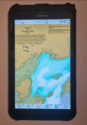
If you are not confident with IT and would like someone to do everything for you then Steve Davis, who trades as London Chart Plotters may be your man. We have no formal relationship with Steve but he has helped a number of users in the past and his services are very inexpensive. He uses Marine Navigator apps and can set everything up for you remotely. He can also sell you a very nice reconditioned ruggedised 8” Samsung tablet, complete with all 850 UK and Ireland ‘UKHO’ charts, for £150 (see below left)!
3D laser-cut framed pictures! In another development, one of our subscribers is now producing these amazing framed images of our charts. Why not order one of your favourite location as a birthday, Christmas or thank-you present?? See details here |
|
If you are not familiar with our charts please look around this website before buying, especially ‘OUR CHARTS’; ‘MAKING’ and ‘USING’
BUY our 2026 charts (£20 for up to 5 of your devices) or update your old charts** (£9).
(**If you have our 2024 or 2025 charts you will be able to acquire a 2026 set at the reduced price of £9)
There is a direct download and automatic setup facility for the Memory-Map version, which is recommended. |
|
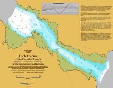
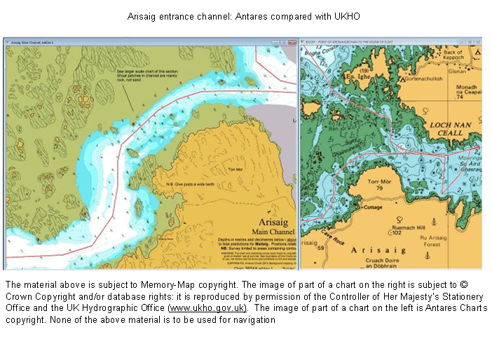
Below is an image of part of our chart of the main channel at Arisaig, at low zoom, alongside the UKHO-type chart at maximum zoom. The charts are displayed on a PC with Memory-Map plotting software. The UKHO-type chart gives you the basics but our chart shows all the detail we found when we went exploring! Our chart can be zoomed a lot further and is complemented by charts of the north channel, the inner part of the loch and an even larger scale chart of the constriction in the main channel.
|
|
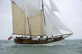
‘Antares’, base for surveying in 2009, now retired to the South of France!
|
|
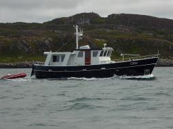
‘Otter’ - base for surveying from 2014 - do call on the VHF if you see us. |
|
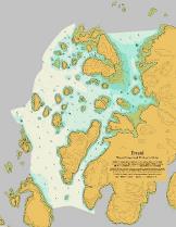
Erraid incl Tinker’s Hole |
|
Ever been in a situation like the one above? You found your way in when the sun was shining but how will you get out? This is just one example where Antares large scale electronic charts might have made a real difference. |
|
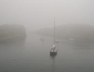
Tinkers Hole in the mist Photo: Martin Lawrence |
|
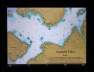
Acarseid Mhor, Rona viewed on an iPad |
|
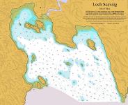
Loch Scavaig, Skye
|
|
Memory-Map. We find the free Memory-Map plotting software coupled with UKHO-type charts to be the ideal platform for our charts. It costs £25 for a one year licence for the UKHO-type UK and Ireland chart package (Marine Charts), which is excellent value. You can run our charts seamlessly with the UKHO-type charts; and with side-by-side windows you can see your position on both. And you can run them all on iPhones, iPads and Android devices as well as PCs and Macs. See example of Arisaig below: all you need is the free Memory-Map app. You can also add in OS walking maps.
|
|
ANTARES CHARTS is a source of 'unofficial' very large scale electronic charts and related pilotage information created by yachtsmen for yachtsmen. Focusing on the West Coast of Scotland it is aimed at experienced navigators, to supplement information available from more authoritative providers. The UK’s official surveying and charting authorities have not resurveyed many of the more interesting channels and anchorages of the West of Scotland since the advent of satellite positioning and often do not publish charts to a sufficiently large scale to meet the needs of the more adventurous yachtsman. Our 2026 charts have now been released. There are 60 new or greatly extended charts and 50 modified charts, making a total of 814 charts. They are available at the unchanged price of £20 to new subscribers or £9 to those who have the 2024 or 2025 sets. Our charts run seamlessly with UKHO-type charts on PCs, Macs, iPads, iPhones and Android tablets and phones. There is a wide range of free apps/software available while ‘the best’ setup costs less than £50, including our charts and all UKHO-type charts for the UK and Ireland. Add in the Ordnance Survey walking maps too, if you wish! WARNING: All information described in this website has been obtained by enthusiasts without formal training. It must be used with great care and entirely at your own risk. See the risk factors outlined under ‘Making the charts’ and ‘Using the charts’. |
|
We welcome contact from users of the charts. Please let us know of any errors or inaccuracies you find. Please also let us have your thoughts on presentational issues, locations for future surveys and other material you think we could provide that you would find useful. As this is an unpaid, part time activity we do not undertake to respond to all correspondence on a timely basis but will endeavour to do so.
To send an email: Tap here
To order charts: Tap here
|
|
NOTE: This website and material obtained from it are the copyright of Antares Charts © and may not be reproduced in whole or in part without express consent; use of all such material is subject to the disclaimers and conditions posted on this website and which may be changed at any time.
|
|
HOME |
OUR CHARTS |
CORRECTIONS |
GUIDES & HELP |
CONTACT |